World
North America
- Canada
- USA
- Alaska and Hawaii
- Middle West
- » Illinois
- » Indiana
- » Iowa
- » Kansas
- » Michigan
- ⇓ Minnesota
-
- Aitkin
- Albert Lea
- Alexandria
- Anoka
- Austin
- Baudette
- Bemidji
- Benson
- Bigfork
- Brainerd
- Brooklyn Center
- Buffalo
- Cambridge
- Canby
- Champlin
- Chanhassen
- Chaska
- Cloquet
- Columbia Heights
- Cook
- Crane Lake
- Crookston
- Crystal
- Detroit Lakes
- Dodge Center
- Duluth
- Duluth Harbor
- East Bethel
- Eden Prairie
- Edina
- Elbow Lake
- Elk River
- Ely
- Eveleth
- Fairmont
- Faribault
- Fergus Falls
- Field of Dreams AP
- Flag Island
- Forest Lake
- Fosston
- Fridley
- Glencoe
- Glenwood
- Grand Marais
- Grand Marais Airport
- Grand Rapids
- Granite Falls
- Hallock
- Ham Lake
- Hibbing
- Hopkins
- Hutchinson
- International Falls
- Inver Grove Heights
- Jackson
- Lake Elmo
- Lakeville
- Lino Lakes
- Litchfield
- Little Falls
- Long Prairie
- Longville
- Luverne
- Madison
- Mahnomen
- Mankato
- Maple Grove
- Maple Lake
- Marshall
- McGregor
- Mendota Heights
- Mine./Blaine
- Mine./Crystal
- Mine./Fly Cld
- Minneapolis
- Minnetonka
- Montevideo
- Moorhead
- Moorhead
- Moose Lake
- Mora
- Morris
- Mounds View
- New Brighton
- New Hope
- New Ulm
- Northfield
- North Mankato
- North St. Paul
- Olivia
- Orr
- Ortonville
- Otsego
- Owatonna
- Park Rapids
- Paynesville
- Pine River
- Pipestone
- Preston
- Princeton
- Prior Lake
- Ramsey
- Red Wing Regional Airport
- Redwood Falls
- Robbinsdale
- Rochester
- Roseau
- Rosemount
- Rush
- Saint Paul
- Saint Paul
- Sauk Centre
- Sauk Rapids
- Savage
- Shakopee
- Shoreview
- Silver Bay Airport
- Slayton
- South St. Paul
- Stanton
- Staples
- St. Cloud
- St James
- St. Louis Park
- St. Michael
- St Paul South
- Thief River F.
- Tracy
- Two Harbors
- Vadnais Heights
- Wadena
- Walker
- Warroad
- Waseca
- Waskish
- West St. Paul
- Wheaton
- White Bear Lake
- Willmar
- Willmar
- Windom
- Winona
- Woodbury
- Worthington
- » Missouri
- » Nebraska
- » North Dakota
- » Ohio
- » South Dakota
- » Wisconsin
- Northeast
- South
- West
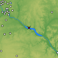
Red Wing Regional Airport Weather forecast
| Sa 27 | Su 28 | Mo 29 | Tu 30 | We 01 | Th 02 | Fr 03 | Sa 04 | |
| Tmax (°C) | 17 | 10 | 13 | 23 | 21 | 14 | 11 | 12 |
| Tmin (°C) | 16 | 8 | 9 | 4 | 8 | 9 | 9 | 3 |
| morning 24-06 |
 |
 |
 |
 |
 |
 |
 |
 |
| a.m. 06-12 |
 |
 |
 |
 |
 |
 |
 |
 |
| p.m. 12-18 |
 |
 |
 |
 |
 |
 |
 |
 |
| evening 18-24 |
 |
 |
 |
 |
 |
 |
 |
 |
| Rain risk | 55 % | 70 % | 55 % | 95 % | 5 % | 55 % | 65 % | 45 % |
| Sunshine hours |  |
 |
 |
 |
 |
 |
 |
 |
| (hrs) | 0.7 | 0.0 | 0.7 | 8.5 | 11.4 | 2.9 | 2.9 | 4.3 |
| UV index | 3 | 1 | 2 | 6 | 7 | 4 | 4 | 4 |
| Sunrise Sunset |
06:05 20:10 |
06:04 20:12 |
06:02 20:13 |
06:01 20:14 |
05:59 20:15 |
05:58 20:16 |
05:57 20:18 |
05:55 20:19 |
| Wind p.m. |  |
 |
 |
 |
 |
 |
 |
 |
| Bft | W 3 | E 3-4 | W 4 | S 3-4 | W 3 | NE 3 | NW 4 | NW 3-4 |
Last updated: Sun 28 Apr 09:26 NZST


| Nearby Forecast Locations - Red Wing Regional Airport | Distance |
| Stanton | 43.0 km |
| Woodbury | 51.4 km |
| Inver Grove Heights | 52.8 km |
| Rosemount | 52.9 km |
| South St. Paul | 54.8 km |
| Northfield | 55.0 km |
| Lakeville | 58.2 km |
| West St. Paul | 59.1 km |
| Menomonie | 60.2 km |
| St Paul South | 60.5 km |
| North St. Paul | 60.9 km |
| Mendota Heights | 61.3 km |
| Saint Paul | 61.6 km |
| Saint Paul | 63.6 km |
| Minneapolis | 66.9 km |
| White Bear Lake | 67.5 km |
| Dodge Center | 68.4 km |
| Vadnais Heights | 69.4 km |
| Shoreview | 75.7 km |
| New Brighton | 76.8 km |
| Columbia Heights | 78.6 km |
| Owatonna | 80.1 km |
| Mounds View | 80.7 km |
| Fridley | 82.2 km |
| Winona | 83.6 km |
Forecast
Red Wing Regional Airport
